Tuesday, May 31, 2016

Camp Penacook & Mt. Chocorua


A small group of ladies met up in Conway, NH to spend the next twenty-four hours in the White Mountains. Upon meeting at the trailhead, we divvied up group gear and food, and then began our hike to Camp Penacook, a lean-to on the southern side of Mount Chocorua just off of the Piper trail. After about 3 miles of hiking, we arrived at the shelter and were pleasantly surprised to be sharing it with 4 more humans and 3 dogs. (Note: Our shelter-mates and their pups were great!)


The rest of the evening was spent relaxing, making dinner, finding a water source, playing cards, and chatting in our sleeping bags. Somehow we all managed to stay up past 9 PM, which is definitely a record of some sort. Typically, we pass out cold before it's dark.; I'm not ashamed to admit that. We also tend to be up early the following morning with the natural light.


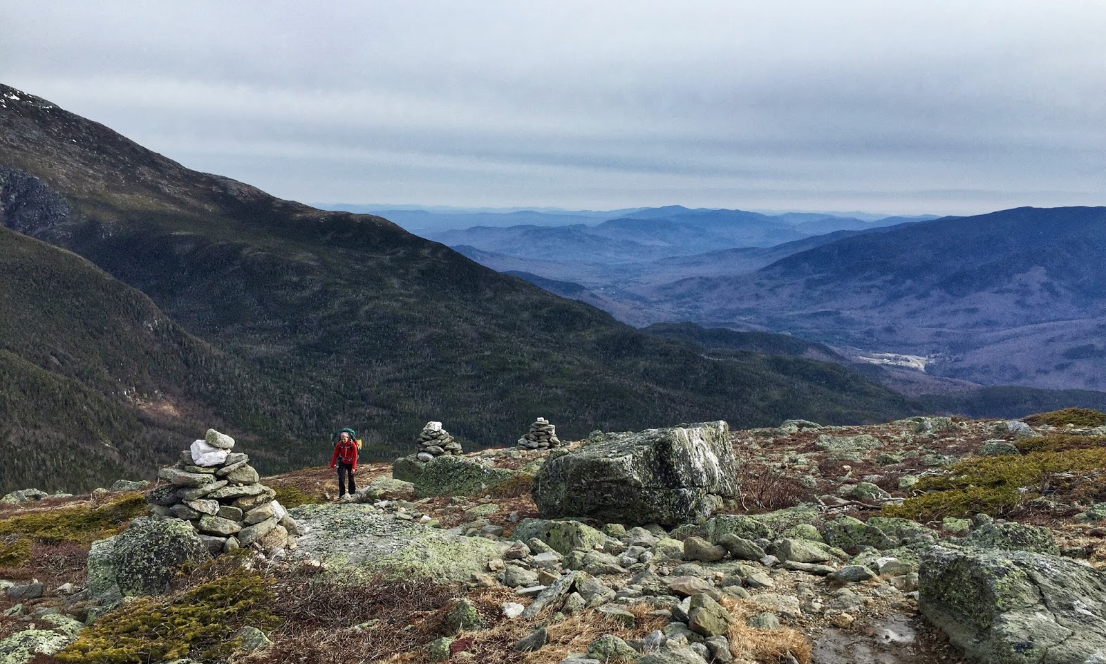
The next morning, we had a quick breakfast before packing our bags (which is a lot quicker when you don't have to take down a tent) and heading for the summit. With our early start on the trail, we beat the crowds and got the summit to ourselves. The descent and return to the trailhead led us down the rocky ledges and back into the heavily wooded on lesser-used, but beautiful trails. 


Tuesday, May 17, 2016

Big Sur Adventures

Looking south from Rocky Point.

A few weeks ago, my Mom and I flew out to San Francisco, rented a car, and drove down the Pacific Coast Highway to the quaint little town of Carmel, Ca. We were in town for the Big Sur Marathon, but the trip was arranged so that we had a full day on either side of race day to explore the area.

Hiking along the North Shore trail in Point Lobos State Preserve.

On our first full day in California we headed to Point Lobos State Preserve, a small peninsula just south of the Carmel. Due to the limited parking inside the preserve, we made a point to be there just as it opened, which meant that we were hiking just after 8 am. We hiked along the rugged coastal trails, as waves crashed on the rocks below us and the fog began to burn off. We saw lots of seals and their pups, swimming and sleeping on the beaches. Several sea otters floated in kelp beds, which bobbed up and down as the waves rolled in.

Hiking along the South Coast trail in Point Lobos State Preserve.

The next day was race day, which meant waking up at 3:00 to make the 3:30 bus to arrive at Big Sur Station around 4:30 where everyone would be hanging out until the race started (finally) at 6:45. Luckily for me, the time change worked in my favor! I won’t go into much detail about the race, but it was an absolutely gorgeous coastal course with amazing views, killer rolling hills and on this day, 20-30 mph headwinds.

The names of all 4,000+ marathoners. Don't worry, I found mine!
Cruising into the finish: almost done!
Finisher's medal: a local artists makes several thousand by hand.

After a shower and a delicious lunch in downtown Carmel, we walked down to the beach. To be honest, it was more of me hobbling to keep up with my mom. Later that afternoon, we drove down the Pacific Coast Highway to Julia Pfeiffer Burns State Park to see McWay Falls. It was a beautiful, winding drive and it covered the entire marathon route and then some.

Looking north from Hurricane Point with Bixby Bridge (mile 13.1) in the distance. 
McWay Falls in Julia Pfeiffer Burns State Park.

On our last full day in California, we did a moderate hike back down in Julia Pfeiffer Burns State Park. We choose the Ewodosen Trail, which took us through towering redwood groves before coming out onto grassy hillsides which steeply dropped away to the PCH and the open ocean. We also took a quick side trip down to Partington Cove, a secluded inlet accessible via an old tunnel.
Redwoods along the Ewodosen trail.
Looking out over the Pacific Ocean from the Ewodosen trail.
The old tunnel leading to Partington Cove.
Exploring Partington Cove and the nearby rocky beach.

Tuesday, May 3, 2016

Hermit Lake: First backpack of 2016!


This past weekend was the first backpacking trip of the year. Pinkham Notch was busy, but luckily for us most of the people out that day were day trippers who were either making the pilgrimage to Tuckerman Ravine to get a few turns in or going up to soak in the sunshine on this bluebird day. We got our overnight permit, packed our food, and headed up the trail in a leisurely fashion. Brittany and I planned to spend the night at the Hermit Lake shelters. The dry trail soon turned icy and we put on our Microspikes to keep from slipping and sliding.


Upon arriving at the shelters, we picked out a lean-to, dropped our packs and ate a quick snack before scampering up to Tuckerman Ravine to watch the skiers. Due to the rather tame winter here in New England, it was impossible to ski down from the bowl, and only the left gully and the bottom half of the headwall were skiable.  Skiers, boarders, and dogs were all out; people were sledding, skiing, drinking beers, and having a grand old time. As the sun dropped lower in the sky, shadows crept across the bowl turning the soft spring corn into an icy, unforgivable slope. We hiked back down to the shelters, played a few rounds of rummy, made dinner, and were in our sleeping bags as dusk fell.

The next morning neither of us really wanted to get out of our cozy sleeping bags, but our desire for breakfast was greater than our desire to stay in bed, so we got up and donned our down jackets, winter hats, and warmest layers. After a nice hot breakfast, we hit the trail. We decided to go down a different way via the Boott Spur Link trail and Boott Spur trail, which meant we first had to ascend quite steeply to the top of a nearby ridge. It was quite the adventure! The trail was incredibly steep and slick with snow; slowly, but surely we gained elevation as we skirted around the icy patches, clinging onto tree branches. Once above treeline, the condition of the trail improved, and we pushed onwards and upwards.


The view from the ridge was impressive: below us lay Hermit Lake and the shelters scattered through the trees, across the way the summit was clearly visible, and beneath the summit cone wind-loaded snow clung to the steep sides of Tuckerman Ravine.


The next couple miles down the Boott Spur trail had a little bit of everything: sweeping views, rock hopping on top of boulders, icy patches, bog bridges, a cool glacial erratic (Split Rock), and a ladder. By the time we reached we made it back down to Pinkham Notch, we were exhausted. The first overnight was a blast, and left us wanting more mountain adventures!