Monday, September 14, 2015

Flags on the 48: Bondcliff


On September 15th 2001, a group of six hikers climbed Mt. Liberty and flew an American flag from the summit in a patriotic remembrance of the events that had transpired four days earlier. The following year, the event Flags on the 48 was organized.


For those of you who are unfamiliar with this event, here is a brief explanation: Every year on the Saturday that falls closest to September 11th, hikers summit each of the 48 4,000 footers in New Hampshire, and raise the American flag in memory of the events that occurred in 2001. The flag will fly from 12 to 2 in the afternoon atop every summit.

This was my third year participating in this event. The previous years, I had hiked South Twin (2013) and Owls Head (2014). This is one of those events that fills up quickly, especially the more popular summits with good views and easy accessibility.

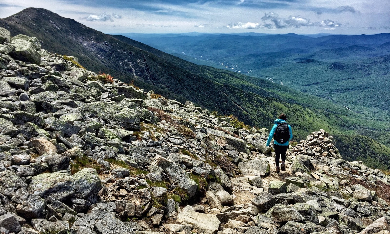
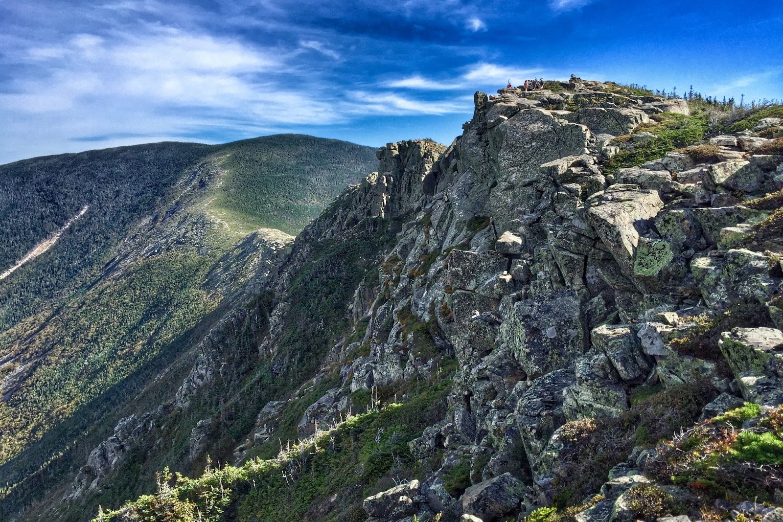
This year I was part of the Bondcliff crew. There were 11 of us who met up before dawn at the Lincoln Woods trailhead. The hike to the summit of Bondcliff is a little over 9 miles; the first half is a pleasant stroll through the woods followed by 4.4 miles of climbing with a short scramble before emerging above treeline. The group made good time and summited an hour early. The flag pole was assembled and the flag raised well before noon. Our peak coordinator, Rick, flew an American flag which had accompanied his brother on a combat mission in Afghanistan in 2004.

The group hung out on top of Bondcliff until 2pm, enjoying the perfect weather, taking in the sweeping views, chatting with fellow hikers, eating our fill and basking in the sunshine. Half of the group took down the flag and headed back to Lincoln Woods, while the other half continued on to complete a Bonds-Zealand traverse.


The five of us who were headed north trekked on to the Bond, West Bond, and Zealand. One of our crew members was finishing up her 48 on West Bond, so we celebrated with a little Fireball atop the summit. The light began to fade shortly after tagging the summit of Zealand, so the headlamps came out as we descended to Zealand Falls Hut, and out to the trailhead.

It was a long day, but it was a most memorable experience in all the best ways possible. All in all, I couldn’t have asked for a greater group of people to spend a day with in the mountains. Hopefully, I’ll see some of you at the 2016 event!


Friday, July 10, 2015

California - Sequoia & Kings Canyon NPs

In mid-June, I took a trip to California to visit my best friend from high school, Dana. We spent four days exploring Sequoia and Kings Canyon National Parks. I could go on and on with details about our amazing trip, but to keep it on the short side, I'll just stick to some of the highlights:

Exploring Grant Grove in the evening. (Photo credit: Dana Vancisin)
Hiking the to alpine lakes via the Watchtower trail. (Photo credit: Dana Vancisin)
Pear Lake.
Evidence of past fires was abundant; many trees had huge fire scars running up their trunks.
Giant Sequoia. (Photo credit: Dana Vancisin)
Kings Canyon National Park: Kings River. 
Kings Canyon is one of the deepest canyons in the US. While the depth of the Grand Canyon is over 6,000 ft, Kings Canyon is over 8,000 ft deep.
We saw several bears, including this mama bear who was watching her cubs. (Photo credit: Dana Vancisin)

Tuesday, June 9, 2015

Ladies do Lafayette

This past Saturday, Emily and I hiked Mt. Lafayette up by Franconia Notch in New Hampshire. Lafayette is one of the most popular mountains to hike in the Whites, so we had decided to take some lesser-known trails up and down it. Our route was the following: up the Skookumchuck trail to the Garfield Ridge trail, which we would follow to the summit, and then descend via the Greenleaf trail. In order to complete the loop, we would have a 3 mile walk on a bike path back to the car.

The Skookumchuck trail was beautiful and without crowds.

We started out under cloudy skies, as we followed the Skookumchuck Brook gradually gaining elevation. The trees grew shorter as we climbed on, changing from a leafy forest to one of small scrubby pines and birch.

At the junction of the Skookumchuck and Garfield Ridge trails.
It began to clear as we descended Lafayette.

Upon reaching the tree line, we bundled up and followed the trail as it disappeared into the fog. The wind had picked up and was gusting quite strongly without any trees to serve as a windbreak. We made it to the summit, which was quite crowded despite the weather. After a quick snack, which we ate huddled down next to a rocky ledge, we headed down the Greenleaf trail. Despite our quick pace down, our hands were freezing from the damp cold wind and it took a while for us to warm back up.

Looking out: Lonesome Lake, Cannon Cliffs, and the AMC Greenleaf Hut.
Looking south from Franconia Notch.

We made it to the AMC Greenleaf Hut, and treated ourselves to multiple $1 cups of hot tea. We spent a good half an hour warming up, sipping on tea, and snacking to our hearts content. With warm, full bellies, we reluctantly left the hut behind us and continued down the Greenleaf trail leaving the crowds of people behind us.

Eagle Pass was very impressive.

It was a steep and rocky descent to Eagle Pass with it's huge boulders. Some snow had survived in the dark shadows, despite the warmer temperatures at the lower elevations. Soon we were able to hear the sound of the cars. After reaching the road, we followed the bike path as it wound through the notch and lead us back to our car (a most beautiful sight to behold!).


Tuesday, June 2, 2015

Smarts Mountain Backpacking Trip

This past weekend was the first of several backpacking trips I had planned for this summer. Several friends and I were headed up to Lyme, NH for an overnight on Smarts Mountain, which is south of Mount Moosilauke on the Appalachian Trail.


After distributing the group gear and food, we followed the white blazed trail up the hillside. This trail is known as Lambert Ridge trail, which is also part of the AT. The combination of the heat and high humidity meant that within minutes of setting out we were sweating. The trail climbed up several open ledges from which we could look out onto the dense green hillsides that surrounded us and enjoy the cooling breeze. 


After passing over the final ledges, we entered back into the shade of the forest as the trail gradually continued on until one last final climb to the summit. We were all quite happy to take our packs off at the tent site and let the breeze cool us down. The tent site was situated a little ways off of the Appalachian Trail, complete with a fire ring and a small log bench that overlooked a pond at the foot of the mountain. Despite the wind, the black flies were still vicious. Crafty little buggers!


We had been guzzling water all day, so a couple of us went to check out the water source, which in the guidebook had been noted as not reliable. It wasn't. Due to the lack of rain this spring, we managed to filter out a liter of water from the standing puddle of water. We walked back to the tent site and after finding a somewhat sheltered location for the stove, we boiled water for our dinner of freeze-dried chili and instant potatoes. After dinner, we took a quick trip over to check out the fire tower. Sadly, it was closed for repairs and the potential $5,000 fine was enough to deter us from sneaking up the stairs for a view.


Thunderstorms were forecasted for the evening, so we tucked everything inside the tents or underneath the rainfly before going to sleep. Probably an hour or two after we got ready for bed, the storm rolled in. Gusts of wind rustled through the trees, billowed the tents and shook the rainflies. The rain started out as a drizzle, turned to a light rain, and then quickly escalated to a driving rain that came in waves. Lightning lit up the tents and the thunder rolled on and on as it echoed through the mountains. I don't think anyone actually slept for several hours, but rather we all just lay in our tents hoping we'd stay dry.


The next morning, we emerged dry from the tents to a grey day, as we were socked in by clouds. I walked to the water source and to my delight, it has turned to a small stream overnight. A thru-hiker that was staying the Ranger's cabin at the top of the mountain seemed reluctant to start out on the trail this morning.

We boiled water for oatmeal and all stood around warming our bellies. Taking down wet tents was not ideal, but at least we weren't out here for another night. We took the Ranger Trail down, which for all purposes was a small flowing brook. We slowly slid, slipped, and hopped down the trail, trying to keep our feet dry for as along as we could. Wet feet were inevitable on a day like that.


After a steep descent for the first half of the trail, the second half was a relaxing walk along an old, soggy, logging road. We made it back to the car just as it had started to rain. We were happy, tired, and a little bit damp. 


Wednesday, May 27, 2015

Here comes summer!

Friday night sunset cruise on Little Ossipee Lake

Memorial Day weekend always starts off the summer…and if my summer is going to be anything like my Memorial Day weekend, then I have lots to look forward to!

Post barefoot 5k at Pineland Farms

The majority of Saturday was spent at a trail running festival in southern Maine, where my friend and I ran a barefoot 5k. We made sure to get there early for the 5k canine cross, in which dogs run with their owners. Shout out to the corgi, the dachshund and all the other little dogs that defied expectations and crushed the 3.1 miles of rolling hills.

Go, doggies, go!

Saturday afternoon, we headed back to the lake and had a relaxing evening complete with a kayak/SUP around the lake.

Out for an evening paddle

Sunday, we hiked Morgan & Percival, two mountains along a ridge over by Squam Lake in NH. The weather was perfect and we met up (though somewhat later than expected) with a geology classmate of mine that I hadn’t seen in two years!

Looking out onto Squam Lake from the rocky outcrops of Mt. Morgan

Tuesday, May 5, 2015

Welch-Dickey Loop

I haven't been doing much hiking lately due to marathon training. I've been itching to get up to the mountains, so I decided to get a short hike in during my taper. This past Sunday, I meet a couple of friends and we drove up to Waterville Valley, NH to hike Welch-Dickey. Despite being only 4.5 miles long, this loop has great views and packs a variety of terrain into just a few hours.

The trail was a little muddy in a few spots and a few small patches of snow lingered in the shade, but overall the trail was in great condition after the long winter. It was a gorgeous spring day with the warmth of the sun, no bugs, views for miles and, of course, great company. We had an absolute blast out there!

The first set of open ledges you come to as you head up Welch.
Squeezing between the split rock on the way up Welch.
Approaching the summit of Welch.
The view from Dickey with a snow-capped Franconia Ridge in the far distance.
Headed down the open ledges of Dickey with a snowy Mt. Moosilauke in the distance.
Rain moving in over the Sandwich Range.

Monday, April 13, 2015

Weekend Wanderings: World's End


This past weekend finally felt like spring had arrived in New England, and I spent Saturday afternoon exploring World's End in Hingham, MA. To my surprise the reservation had a little bit of everything, including: rolling hills (technically, drumlins); rocky shorelines; winding trails; tidal marshes; a view of the Boston skyline; and, some fascinating geology.